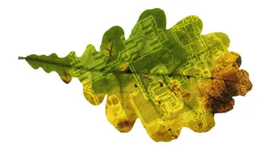
The Physical & Environmental Geography Research Group advances fundamental knowledge of water, land, atmosphere and ecosystems to tackle critical environmental and societal challenges.
Our research themes, methods and outputs are highly interdisciplinary, with a strong focus on exploring human-environment interactions across many different landscapes and scales. We are pioneers in linking computer-based simulation modelling and laboratory experimental work to field environmental monitoring campaigns using both in situ sensor networks and satellite/airborne remote sensing, alongside mapping and mixed-methods approaches. Another key strength is generating data-driven inputs that feed into decision-support, forecasting and management interventions for land-use change or environmental hazards. Our research activities are closely supported by the John B Thornes laboratory and technical team.
We work with a wide range of partners and collaborators, including international research networks, government agencies, private sector and NGOs and we place strong emphasis on science-driven geographical education and public engagement.
Key research themes are:
- Climate change drivers and impacts – past, present and future
- Ecological and landscape dynamics including invasive species, biogeochemical cycles, land-use change and geomorphological processes
- Environmental hazards such as fire, floods, and drought
- Pollution sources, sinks and impacts in aquatic, terrestrial and urban settings
- Sustainability with a focus on food systems and land management
People

Reader in Climate and Society

PhD student

Research Associate

Professor of Aeolian Geomorphology

Lab Technician

Lecturer in Natural and Environmental Hazards
Projects

Atmospheric Circulation Reconstructions over the Earth (ACRE)
The Atmospheric Circulation Reconstructions over the Earth (ACRE) initiative undertakes and facilitates the recovery of historical instrumental surface terrestrial and marine global weather observations to underpin 3D weather reconstructions for climate applications and impacts needs worldwide.
Landslide multi-hazard risk assessment, preparedness and early warning in South Asia integrating meteorology, landscape and society (LANDSLIP)
LANDSLIP is a large multi-team four-year project led by King’s and the British Geological Survey, focussed on reducing impacts of hydrologically-related landslide multi-hazards and building resilience to landslides in vulnerable and hazard-prone areas of India and South Asia.

A Satellite-Based Water Quality Monitoring Tool for East African Lakes
This interactive, web-based platform harnesses satellite data to provide near real-time and historical insights into lake water quality.
Geodata Portal
A public environmental data portal providing information (raw and visualised) to the scientific and conservation communities.
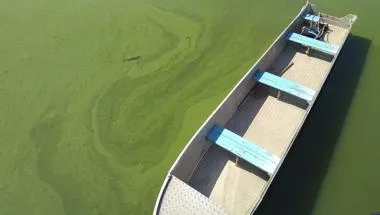
Mapping harmful algal bloom dynamics in Lake Victoria to understand the impact on local communities
This projects looks at detecting harmful algal blooms (HABs) conditions and their extent at Lake Victoria, East Africa.
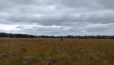
Testing the role of nutrient input thresholds in governing microbial-mediated carbon sequestration for temperate peatlands
Examining palaeoclimate data & genomic sequencing of microbial communities to understand how peatlands have responded to changes in nutrients over 2000 years.
Publications
News
King's expert in wildfires and satellite imaging awarded MBE in New Year Honours
Recognition for researcher who helped bring global attention to landscape fire and smoke
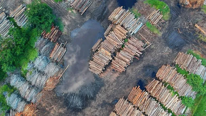
Brazilian conservation policy less effective on private lands
A policy designed to conserve forests has been less effective on privately-owned land in the Amazon due to an exemption for small property owners, leading to...
Protecting areas most important to people will benefit nature too
Prioritising nature conservation in areas that directly benefit humans would lead to more equitable and just conservation decisions, finds major global study.

People
Reader in Climate and Society
PhD student
Research Associate
Professor of Aeolian Geomorphology
Lab Technician
Lecturer in Natural and Environmental Hazards
Projects
Atmospheric Circulation Reconstructions over the Earth (ACRE)
The Atmospheric Circulation Reconstructions over the Earth (ACRE) initiative undertakes and facilitates the recovery of historical instrumental surface terrestrial and marine global weather observations to underpin 3D weather reconstructions for climate applications and impacts needs worldwide.
Landslide multi-hazard risk assessment, preparedness and early warning in South Asia integrating meteorology, landscape and society (LANDSLIP)
LANDSLIP is a large multi-team four-year project led by King’s and the British Geological Survey, focussed on reducing impacts of hydrologically-related landslide multi-hazards and building resilience to landslides in vulnerable and hazard-prone areas of India and South Asia.
A Satellite-Based Water Quality Monitoring Tool for East African Lakes
This interactive, web-based platform harnesses satellite data to provide near real-time and historical insights into lake water quality.
Geodata Portal
A public environmental data portal providing information (raw and visualised) to the scientific and conservation communities.
Mapping harmful algal bloom dynamics in Lake Victoria to understand the impact on local communities
This projects looks at detecting harmful algal blooms (HABs) conditions and their extent at Lake Victoria, East Africa.
Testing the role of nutrient input thresholds in governing microbial-mediated carbon sequestration for temperate peatlands
Examining palaeoclimate data & genomic sequencing of microbial communities to understand how peatlands have responded to changes in nutrients over 2000 years.
Publications
News
King's expert in wildfires and satellite imaging awarded MBE in New Year Honours
Recognition for researcher who helped bring global attention to landscape fire and smoke
Brazilian conservation policy less effective on private lands
A policy designed to conserve forests has been less effective on privately-owned land in the Amazon due to an exemption for small property owners, leading to...
Protecting areas most important to people will benefit nature too
Prioritising nature conservation in areas that directly benefit humans would lead to more equitable and just conservation decisions, finds major global study.
Group lead

Associate Dean (Research Culture)
Contact us
Research Computing Officer: Dr Jiangping He